3 D Maps created using OziExplorer 3D (6/7)
3 D Maps created using OziExplorer 3D

3D map grid
This grid / DEM consists of some 100 x 100 values, representing a 5 m grid in nature.
The naked relief of al hill.
The principle: Imposing 2 D maps on 3 D grids
The 3 D map software OziExplorer3D uses a DEM (generated using MATLAB or received from another source) to place an ordinary 2 D map on top of the 3 D shape. Thus the 2 D map becomes the texture. To increase the 3 D effect optional lighting is available.
3 D color map green

3D map green no light
If we use some of the 2 D color maps created above we get results like these.
3 D color map gray
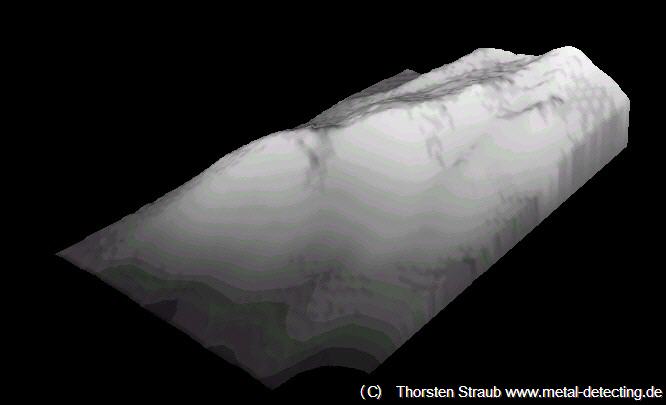
3 D map grey
The absence of contour lines and color helps to place find information on this grey map.
Other color sets
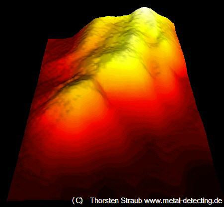
3 D map hot
Other colors make the hill appear to “glow”.
Application: 3 D Find Map

3 D Find Map.
If this is applied to one of the 2 D findmaps the result looks like that
Anything goes
Of course, it only makes sense to do this with pictures that show geographical information. Technically speaking, though, the map software accepts all sorts of picture files as textures. This principle gives the user a lot of freedom.
Turning and Zooming

Skull Hill 3 D Map Best Finds.
With OziExplorer 3D maps can be turned and zoomed into the most favourable position. .
Best find overview.
Zoom Effect

Zoomed 3 D Map.
Zoomed 3 D map without find symbols. Dashed line is the abandoned way
Aerial photos
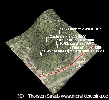
Skull Hill 3 D Map Best Finds Aerial Foto.
Using aerial pictures as textures can make nice effects as well. Lets conclude this article with a 3D aerial photo combined with the positions of the best finds.
The combination of the 2D and 3D maps shown above can be helpful in many aspects of treasure hunting. I would be glad if some readers got inspired by these pictures.
Thorsten Straub, website version June 2006
(C) Thorsten Straub www.metal-detecting.de 2006-2019.